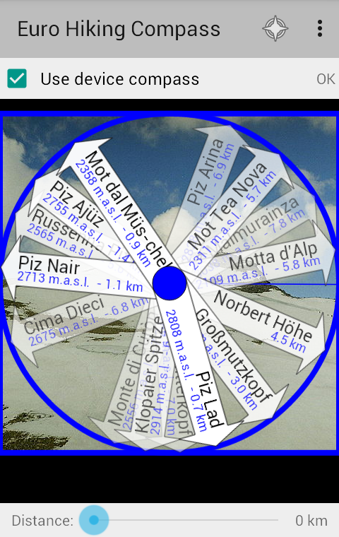
When your device is flat you see a compass with arrows pointing towards the tops, and when it's held upright you see an augmented reality camera view. In camera view you can take photos, and the names of the tops and other places will be printed on the picture. The app can also display a map, where tops whitin a radius of approximately 60 km are marked. Swipe over the screen to swap between compass and map.
You can choose if you want arrows/markers for all available hills and mountains, or if you prefer mountains only. You can also choose to see other terrain formations like valleys and capes, waters and lakes, or other names like populated places.
The app uses offline data, which means that it will also work without an Internet connection. But there are a few exceptions: You need Internet connection if you want to download new maps. These will be temporary stored on your device, and consequently work partly offline later. You also need Internet connection the first time you are starting the app, so it can do a piracy check. A new check on this will be done at least every third month.
---
Want to test before your buy? Check out the free app "Norwegian Cities and Villages":
https://play.google.com/store/apps/details?id=com.spillby.android.norskekommunesenter
It show different (Norwegian) data, but work in a similar way as the Euro Hiking Compass (you can use a fake GPS app to pretend you are in Norway).
Something you are missing in the app? Tell me on Facebook or send an e-mail!
Didn't like the app after all? I give a one month guarantee: Send me an e-mail and tell me what you didn't like, and I'll refund your money if I can't fix it.
Data source: Geonames.org, licenced under Creative Commons Attribution. The data covers all of Europe, from Iceland, Svalbard, Gibraltar, Istanbul and at least parts of the Ural Mountains.
Note: The first time you run the app it will need 2-4 minutes to prepare its data source.
We do not host European Hiking Compass on our servers. We did not scan it for viruses, adware, spyware or other type of malware. This app is hosted by Google and passed their terms and conditions to be listed there. We recommend caution when installing it.
The Google Play link for European Hiking Compass is provided to you by apps112.com without any warranties, representations or guarantees of any kind, so access it at your own risk.
If you have questions regarding this particular app contact the publisher directly. For questions about the functionalities of apps112.com contact us.

|
| ||||
| Downloads: 2 | ||||
| Updated At: 2024-04-19 23:54:23 | ||||
| Publisher: Christian Berge | ||||
| Operating System: Android | ||||
| License Type: Free Trial |